Soil Moisture Sampling
Soil Moisture Sampling Overview
HDAS soil moisture measurements
Users can download the soil moisture data of the corresponding patch via the Download Centre.
Hydraprobe Data Acquisition System
Soil moisture measurements during SMAPEx were undertaken using the Hydraprobe Data Acquisition System (HDAS), a powerful spatial data acquisition tool developed by the investigators which integrates a handheld Pocket PC, a Stevens Water Hydraprobe and a GPS receiver into a mobile GIS environment. This system allows navigating to predefined sampling locations and collecting and storing in real-time a variety of spatial data, including the soil moisture, soil temperature and soil salinity provided by the probe as well as a variety of user-prompted observations (land cover type, vegetation canopy height, visual observation of dew presence, visual estimate of surface rock cover fraction, irrigation type).
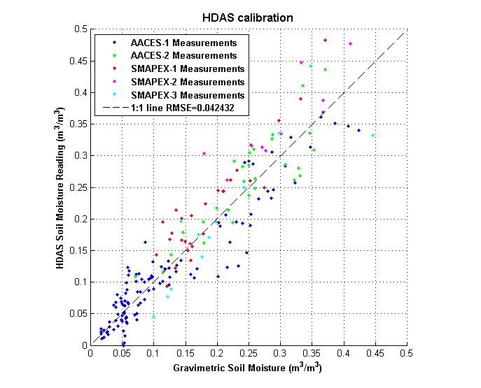
Hydraprobe Calibration
The soil moisture calibration equation for the HDAS was derived from the analysis of a large number of laboratory and field gravimetric samples collected in previous campaigns by Merlin et al (2007). The quality of the calibration was confirmed by analysis of gravimetric data from the SMAPEx and related AACES experiments.